Today's M5.8 Earthquake in Virginia - II

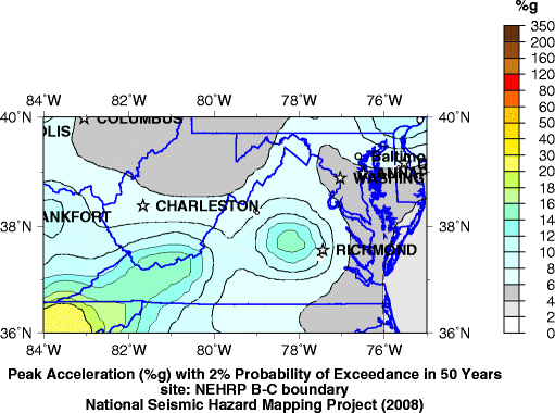
In 2008, the US Geological Survey published a map of probability of ground motion over the next 50 years. The map was based on historic earthquakes as well as recent seismicity (smaller earthquakes). The area hit by todays M5.8 earthquake was identified as the most likely location in that region.
The map from the USGS is below:
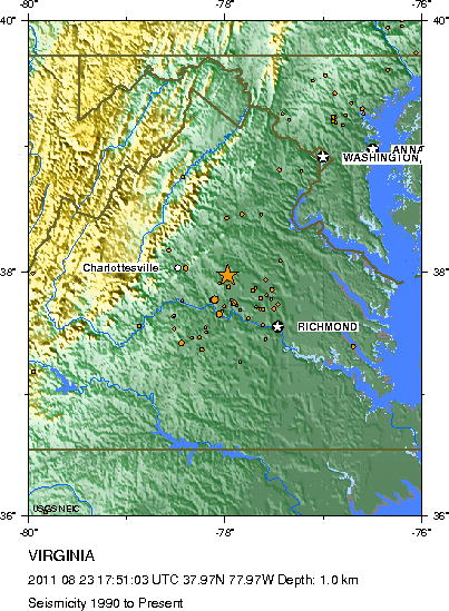
In addition, there were 2 smaller events that occurred in 2008, a M3.9 and a M4.5. The activity since 1990 is shown below.
About OpenHazards Bloggers
 Steven Ward is a Research Geophysicist at
the Institute of Geophysics and Planetary Physics, UC Santa Cruz. He specializes in the quantification and simulation of
natural hazards. Read Steve's blog.
Steven Ward is a Research Geophysicist at
the Institute of Geophysics and Planetary Physics, UC Santa Cruz. He specializes in the quantification and simulation of
natural hazards. Read Steve's blog.
 John Rundle is a Distinguished Professor of Physics
and Geology at UC Davis and
the Executive Director of the APEC Collaboration for Earthquake Simulations. He
chaired the Board of Advisors for the Southern California Earthquake Center from 1994 to 1996. Read John's blog.
John Rundle is a Distinguished Professor of Physics
and Geology at UC Davis and
the Executive Director of the APEC Collaboration for Earthquake Simulations. He
chaired the Board of Advisors for the Southern California Earthquake Center from 1994 to 1996. Read John's blog.